

Trail Highlights
| Location | Trinity Divide |
| Length | 12 miles (round trip) |
| Elevation gain / max | 1,300′ / 7,300′ |
| Difficulty | Moderate |
| When to go | June – Oct |
| Other restrictions | No bikes (PCT) |
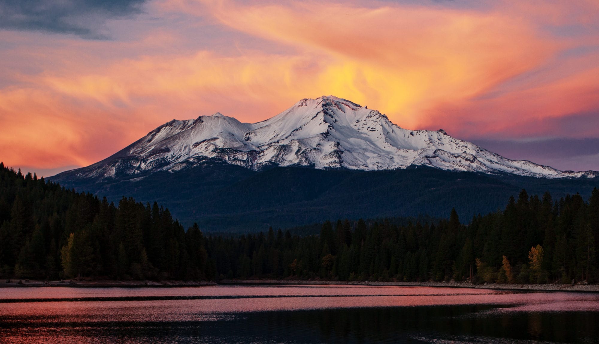
This walk along the Pacific Crest Trail features exhilarating views of major northern California landmarks ranging from Lassen Peak to Mount Shasta to Mount Eddy to the Trinity Alps and other Klamath Mountain ranges. You’ll also visit Porcupine Lake, pass by meadows and springs, and walk near the head of a glacial cirque with an amazing display of wildflowers.
Trail Map

Other Maps
Trail Details
Follow the below directions to the trailhead, an unsigned intersection with the PCT at Picayune Summit. Follow the trail north, looking north to Mount Eddy and west down to Picayune Lake.
Continue straight and climb, soon reaching a series of spring-fed and flower-festooned meadows that stretch west down the mountainside (one spring flows year-round). The PCT returns to the east side of the crest and walks by more meadows and a thick red fir forest, then enters open country with an expansive vista southeast to Lassen Peak and its neighboring volcanoes.
Reach a trail fork at 5 miles and go left, leaving the Pacific Crest Trail for a brief climb to Porcupine Lake. Surrounded by the high rock walls of its glacial cirque, this beautiful lake has deep, clear waters for swimming and several campsites near the eastern shore. If you see Toad Lake, you have gone beyond the turnoff to Porcupine; the view of Toad is a worthwhile extension to your day hike.
Controlling Agency:
Mount Shasta Ranger Station
Shasta-Trinity National Forest
204 West Alma, Mount Shasta, CA 96067
(530) 926-4511 http://www.fs.fed.us/r5/shastatrinity
Directions to Trailhead
From I-5, take the Central Mount Shasta / Lake St exit, and head west to the intersection with N. Old Stage road, home to the Mt Shasta Fish Hatchery.
Directions to Picayune Summit from the Hatchery:
| Miles from start | Direction |
| Start (0.0 mi) | Head southeast on S Old Stage Rd toward Lake Siskiyou |
| Mile 0.3 | Slight right onto W A Barr Rd, continue 5.2 mi |
| Mile 5.5 | W A Barr Rd becomes Forest Rte 26, continue 9.4 mi |
| Mile 14.9 | At FR 40N37, slight right to stay on FR 26 for 1.4 mi |
| Mile 16.3 | Turn right onto 40N45, continue 0.7 mi |
| Mile 17.0 | Picayune Summit (PCT) (No signs) |
Support MSTA
MSTA develops and maintains trails in the Mount Shasta area, and advocates for hiking, biking and equestrian access. We are a volunteer-based 501(c)(3) non-profit organization and count on your support. Please consider giving back to your trails!
