


Trail Highlights
| Length | 7.0 miles (round trip) |
| Elevation gain / max | Negligible / 3,260′ |
| Difficulty | Easy |
| When to go | Year-Round |
| Dogs allowed? | Yes, on-leash |
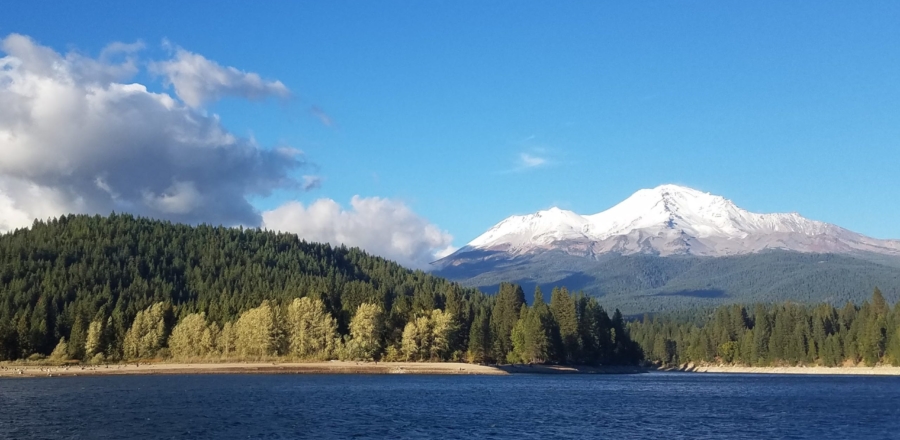
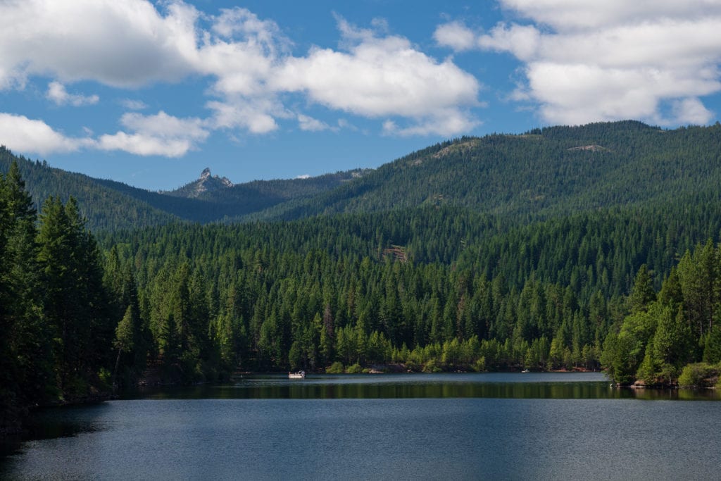
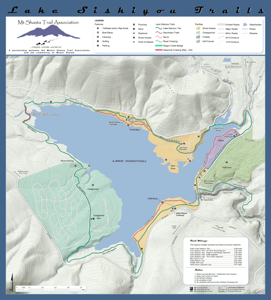
The Lake Siskiyou Trail follows the shore of a gorgeous reservoir with easily accessible views of Mt Shasta and Mt Eddy and frequent opportunities to swim, fish, and bike. Completing the full loop is only possible in the summer months when the Sacramento River’s delta is bridged (approx May-Oct); section hikes are possible year round.
As of January the seasonal bridges are NOT in at the Delta. They usually are reinstalled for Memorial Day.
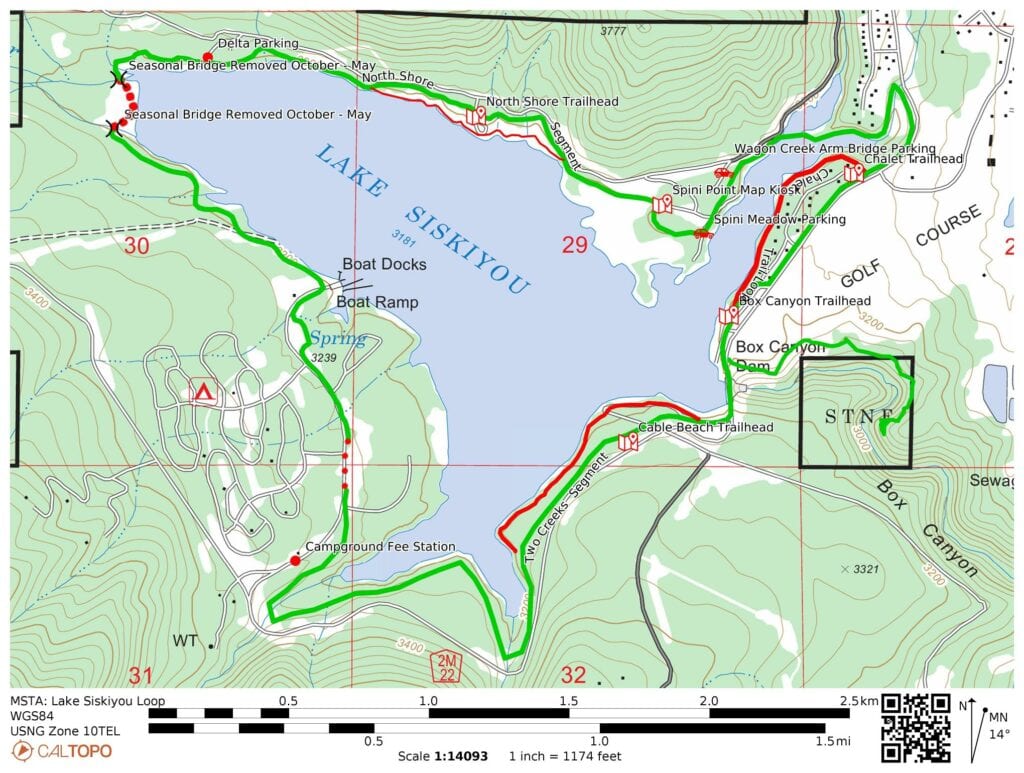
Trail Map
Other Maps
Link to the Caltopo Map used to generate these maps.
Note the free Caltopo website lets you export files in *.gpx (generic gps file) / *.kml (Google Earth) or *.gpsio (Garmin Connect) formats for use with your favorite GPS software.
AllTrails: Lake Siskiyou Trail
Trail Details
This loop trail can be hiked starting from several trailheads and can be completed clockwise or counterclockwise, so the directions described here are just one of many possible options. The loop also includes several alternate routes that split from and then rejoin the main trail, adding variety.
The most popular hiking option circles the lake clockwise beginning at the Cable Beach parking area (see directions below). Proceed past the parking area’s trail kiosk down an accessible ramp, then turn left to follow the main train, which is wide and well marked. After about 1.5 miles, the trail will pass through the Lake Siskiyou Resort and Campground. Please be respectful of guests and stay on the main trail. Another 1.4 miles will bring you past the marina; 0.8 miles beyond that you will arrive at the Sacramento River’s delta into the lake.
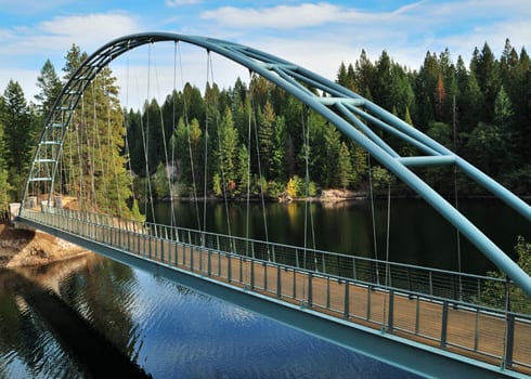
If the seasonal delta bridge is in place, cross it and continue along the lake’s North Shore past lovely meadows and another trailhead until you reach the Wagon Creek Bridge. Beyond the bridge, the trail turns south to parallel W.A. Barr Rd. The alternate Chalet Trail along this section is narrow but more scenic. Both options proceed south past additional trailheads, rejoining just before the Box Canyon Dam. Cross the dam and bear right to return to the Cable Beach Parking Area, completing the loop.
Directions to the Trailhead
As noted above, the Siskiyou Lake Trail can be accessed from multiple trailheads. The trail details on this page describe the route beginning at Cable Beach. Alternate trailheads include Box Canyon Dam, the North Shore, and several others.
From the I-5 Central Mt Shasta City exit:
- Take Lake Street west towards Lake Siskiyou
- Turn left onto Old Stage Road at the stop sign
- After 0.25 miles, bear right onto W.A. Barr Rd (following signs for Lake Siskiyou
- Continue 2.3 miles to Cable Beach Parking Area. The parking area is on the right immediately after Castle Lake Rd.
Land Agency: Siskiyou County Flood Control and Water Conservation District
Check out their website for status of the seasonal bridges across the Sacramento River delta where it flows into the lake. https://www.co.siskiyou.ca.us/floodcontrol/page/flood-control-and-water-conservation-district
Support MSTA
MSTA develops and maintains trails in the Mount Shasta area, and advocates for hiking, biking and equestrian access. We are a volunteer-based 501(c)(3) non-profit organization and count on your support. Please consider giving back to your trails!
