


Trail Highlights
| Length | 5.4 miles (round trip) |
| High point | 4,800′ |
| Elevation gain | 2,200′ |
| Difficulty | Strenuous |
| When to go | April – Nov |
| Dogs allowed? | No |
| Other restrictions | Site-specific restrictions |
Castle Dome and Indian Springs (the Crags Trail) rises from Castle Crags State Park into the USFS Castle Crags wilderness, offering a mixed hike / light scramble with stunning views of Mount Shasta, steep granite and a lush spring.
Controlling Agencies
CA State Parks (Castle Crags State Park)
US Forest Service (Castle Crags Wilderness)
Things to Know
- Castle Crags SP charges an entrance fee ($8 day use as of 2019)
- Wear bug spray! The lower elevations are moist and insect-friendly.
- Upper elevations involve some minor exposure and scrambling
Trail Map
Other Maps
Trail Details
From the Vista Point parking lot, walk back down the road 150 feet to an accessible parking space and trailhead. Follow signs for the Crags Trail.
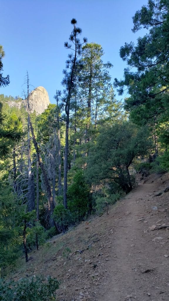
Start walking level through a mixed forest that will be with you for much of the hike. Bear left at a trail fork at .2 mile. Cross the Pacific Crest Trail at .5 mile, continue along the Crags Trail and climb steadily. At 2 miles a side trail to the left leads a quarter mile to shady Indian Springs, an ecologically sensitive area that is the hike’s only sure source of water.
Shortly above Indian Springs you encounter a US Forest Service sign and a stunning view of Castle Dome with Mt Shasta. For those seeking an easier hike, this is a great vista and turnaround spot.
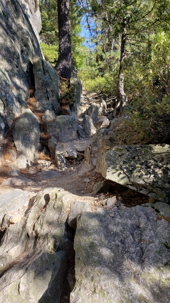
The main path continues upward, soon leaving the forest behind and guiding you into spectacular open scenery. The trail becomes rougher here as you begin to encounter the granite crags themselves. In spots, steps of 12 – 14″ are common. Pay attention to the route behind you! It is easy to become disoriented in this region on the way back.
The base of Castle Dome awaits 3 miles into the journey. This is a great spot to soak in Mount Shasta and Castle Crags. Climbers with the proper equipment and expertise can attempt a climb of Castle Dome itself.
Directions to the Trailhead
Take the Castella exit off I-5 about 6 miles south of Dunsmuir. Go west and follow the signs for Castle Crags State Park (entrance fee). Follow the main road 1.3 miles through the park to the Vista Point parking area.
Other Trails
Not the trail you were looking for? Check out our trail guides for over 20 great hikes in the area!