


Trail Highlights
Greenhorn Park has a multitude of trails to explore for hikers, bikers and strollers. The birds around Greenhorn Reservoir and the remnants of mining activity are among the highlights.
Trailhead Location: The primary point to start is at the parking area, picnic area, lawn area accessed off of Greenhorn Road.
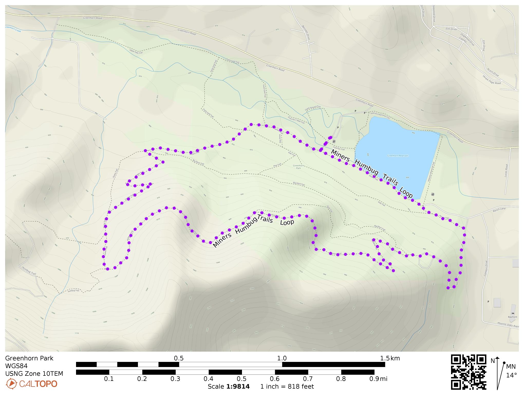
Suggested Introductory Loop:
Length 3-3/4 miles
Elevation Gain / Range: 700 ft gain from elevation 2700 to 3300 feet
Difficulty: Easy to Moderate
When to go: All year
Cell Service: Great
Trail Maps
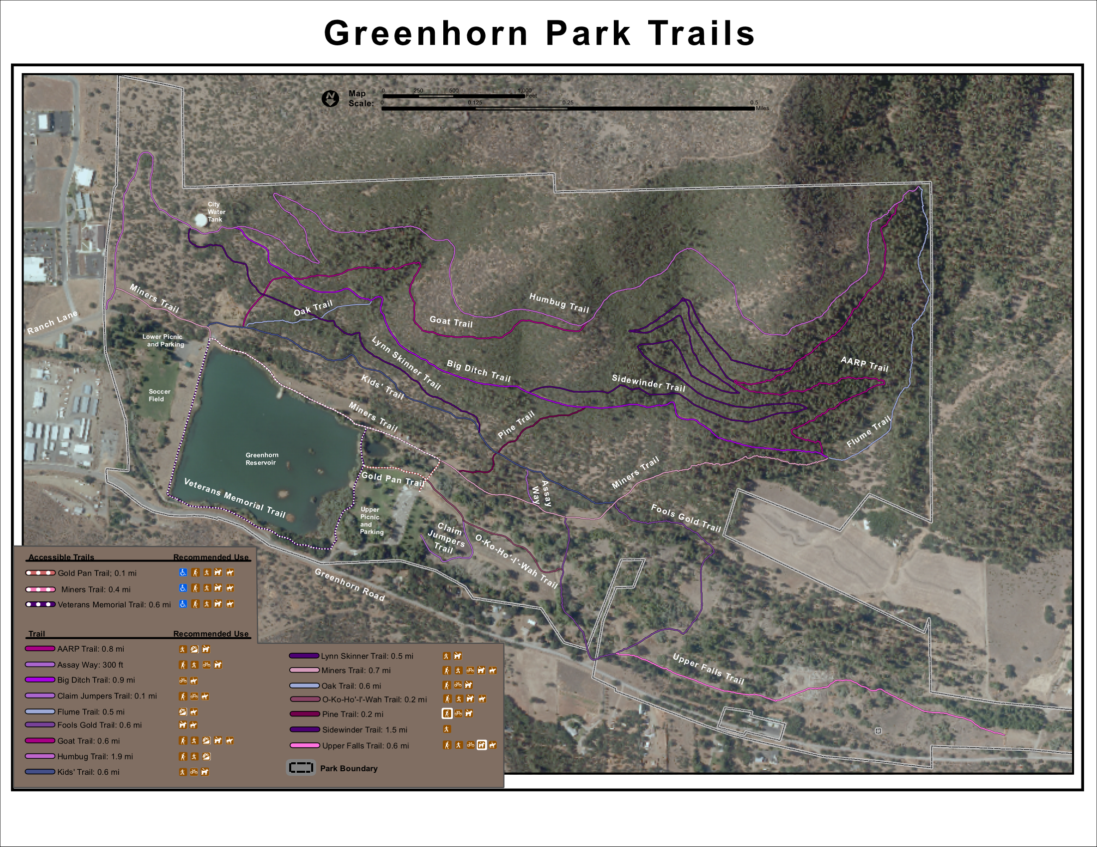
Note you can load this map directly into the free CalTopo app by using the QR code.
Note the free Caltopo website lets you export files in *.gpx (generic gps file) / *.kml (Google Earth) or *.gpsio (Garmin Connect) formats for use with your favorite GPS software.
Trail Details:
There are a multitude of trails and types of trails to explore.
You can also find remnants of the areas mining activity,
From the upper parts of the western end of the park, you can extend your explorations on unsigned trails in the adjacent Klamath National Forest: see the maps provided.
For the suggested introductory loop:
- Start from the south end of the parking lot and cross the creek
- Head left on Miner’s Trail
- The trail continues along the shore of Greenhorn Reservoir to just beyond the dam
- Turn right onto an old road that ascends to the water tank.
- At the water tank: pass around its downhill side and find the Humbug Trail branching up to the left
- Follow the Humbug Trail for about 1-1/3 miles to the west as it contours around the hill with views out over Yreka
- Turn right on the Flume Trail and head down the hill. You can take it or the Confifer / AARP trails down to where those trails join up again and meet the Miner’s and Big Ditch Trails
- Follow the Miner’s Trail back to the beginning.
Directions to the Trailhead: “Greenhorn Park” in Google Maps. From I-5 Exit Go 0.6 miles north on S. Main St, turn left (west) on Greenhorn Road and go 0.7 miles west to the park entrance. It will be on your left just after you pass Greenhorn Reservoir. The start of the suggested loop trail is at the far south end of the parking area.
Land Agency: City of Yreka
Phone: (530) 841-2300