

Trail Highlights
| Trailhead location | Castle Lake parking, 10 miles SW Mt Shasta City |
| Length | 2.2 miles (round trip) |
| Elevation gain / max | 600′ / 6,050′ |
| Difficulty | Moderate |
| When to go | May – Nov (trail), Year round (snow) |
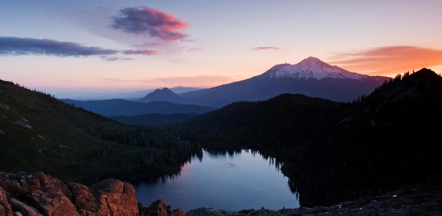
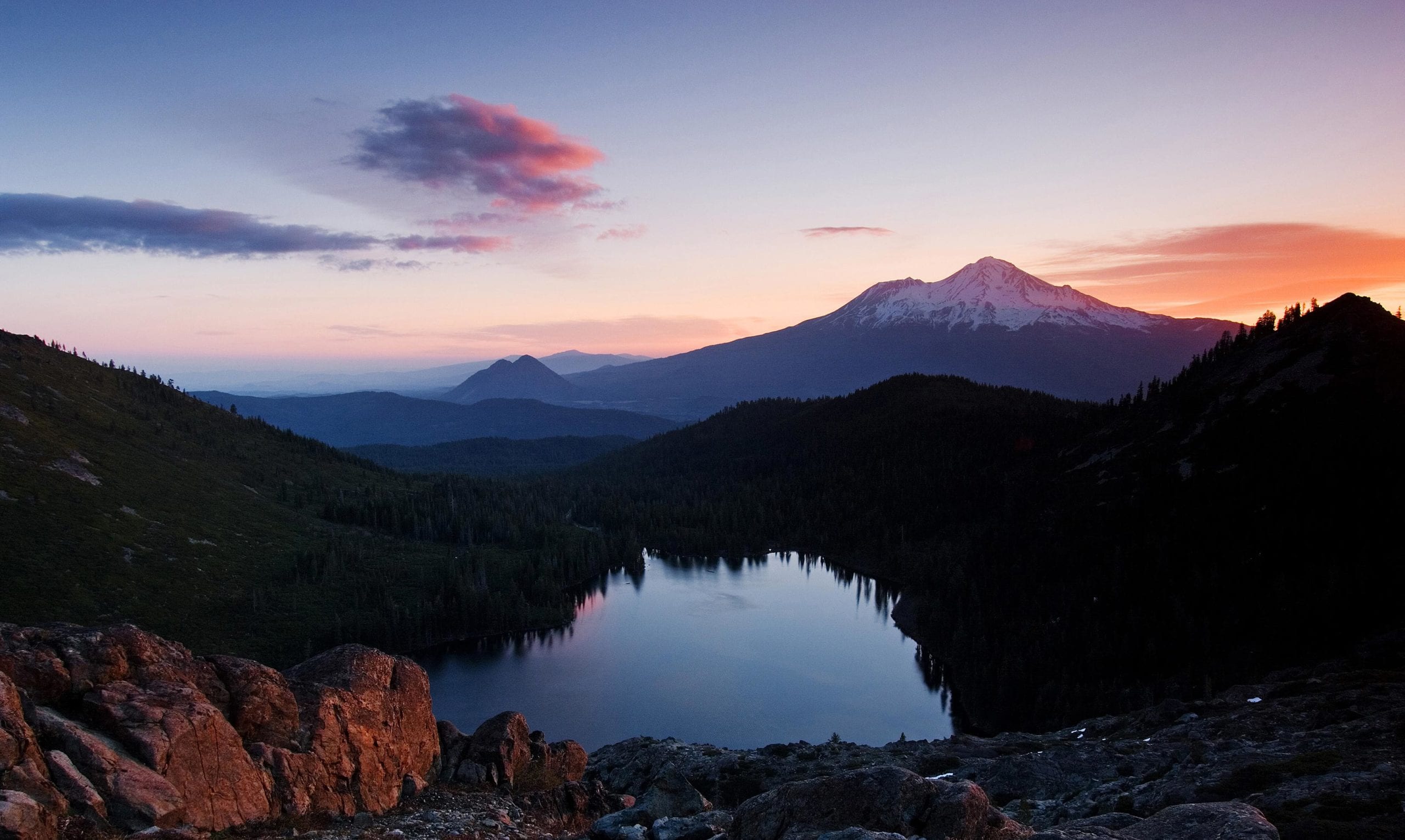
This is one of the premier hikes in the Mount Shasta region, giving large rewards for a modest effort. The climb to peaceful Heart Lake opens views to Black Butte, Mount Shasta, Mount McLoughlin and the surrounding country.
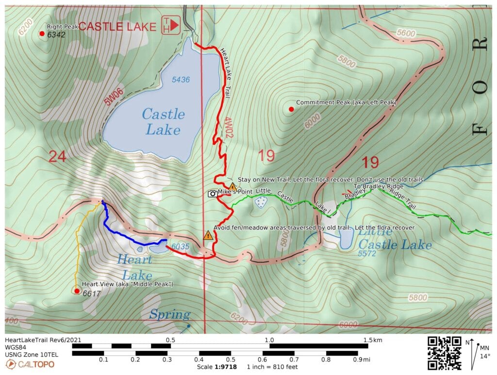
Trail Map
Other Maps
AllTrails: Heart Lake Trail from Castle Lake
Trail Details
Follow the trail: Conservation of this ecosystem is vital, and this trail is extremely popular – please help by staying on the primary trail at all times. Avoid the old decommissioned trails: let the flora recover. If it is green don’t tread there.
Starting from the Castle Lake parking lot, head southeast along the trail, across a small drainage stream. In the spring, this delta may require some careful crossing.
Follow the trail up a moderate incline along Castle Lake’s eastern shore. Follow the new (2021) trail alignment as it switchbacks in the forest, providing new vistas of the lake as you go.
When the trail leaves the forest and enters the alpine zone, follow the new trail as it avoids all the areas damaged by random trails all over the terrain. The trail contours around a rocky point for more new and enticing views of Castle Lake and the cliff areas above. The trail swings back and forth across the alpine zone as it gently climbs: don’t be tempted to cut the switchbacks using old decommissioned trails.
The trail reaches a crest adjacent to an old pine. The main trail swings left, but there is a lateral trail to the right that takes you out onto a flattish rock with great views (Mike’s Point); it is well worth the very short detour.
The trail crosses a small meadow area on a new set of stepping stones just before it reaches the junction with the trail to Little Castle Lake and Bradley Ridge / Mt. Bradley. Follow the signs and the trail to Heart Lake curves gently around the upper end of a small meadow: let the meadow recover.
The trail then follows the old primary trail up a rocky section: look for the cairns marking the way: don’t create new routes.
As the trail gets to a small crest, follow the new trail cut through low brush on the left. This section avoids a meadow that was spectacular with flowers at the turn of the century, but was trashed by the previous trail network.
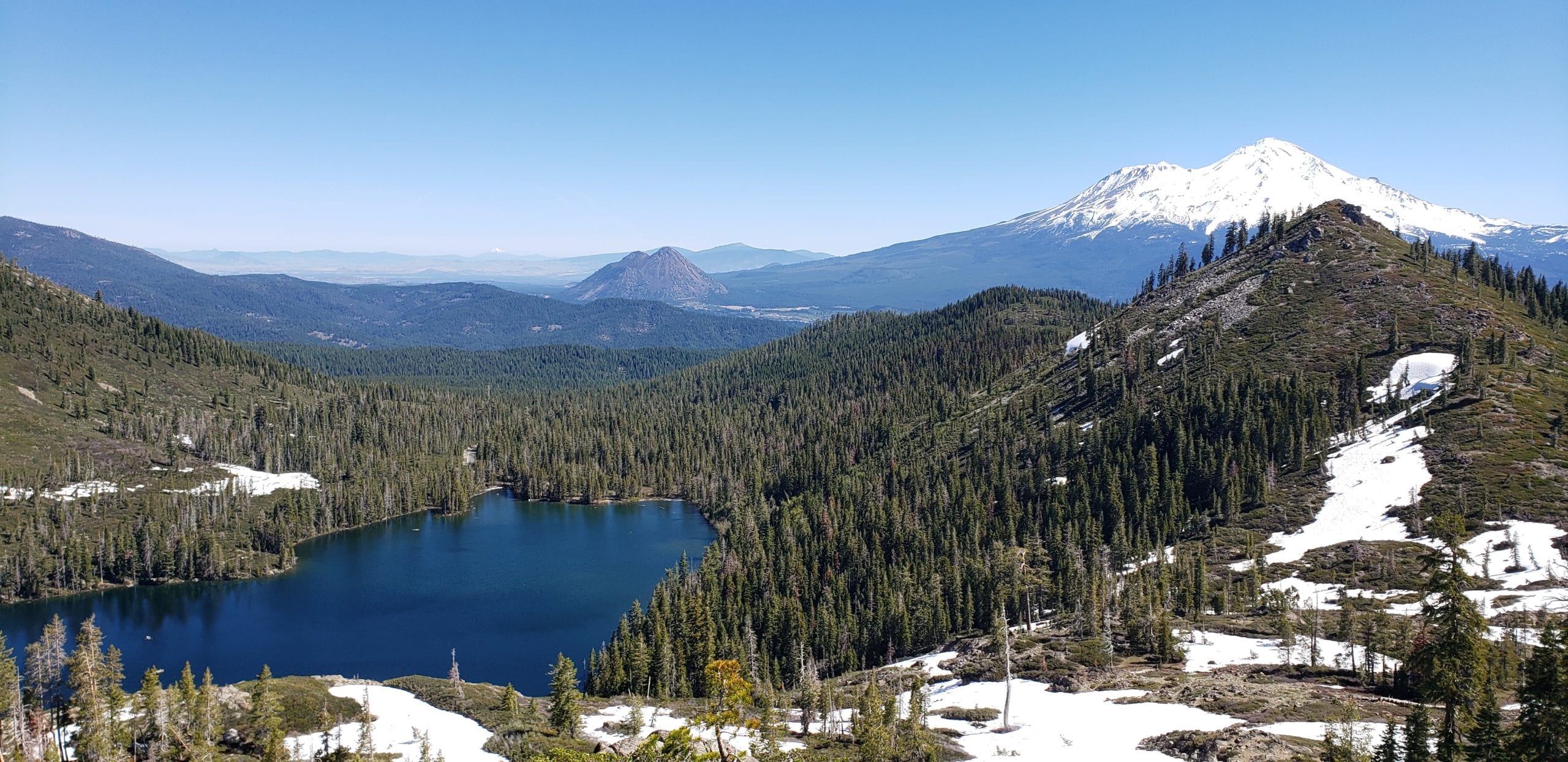
Continue following the new trail as it gently rises to the base of the upper slope. It then curves to the left and gently contours to the saddle just east of Heart Lake. Enjoy the views of Mt. Shasta across meadows.
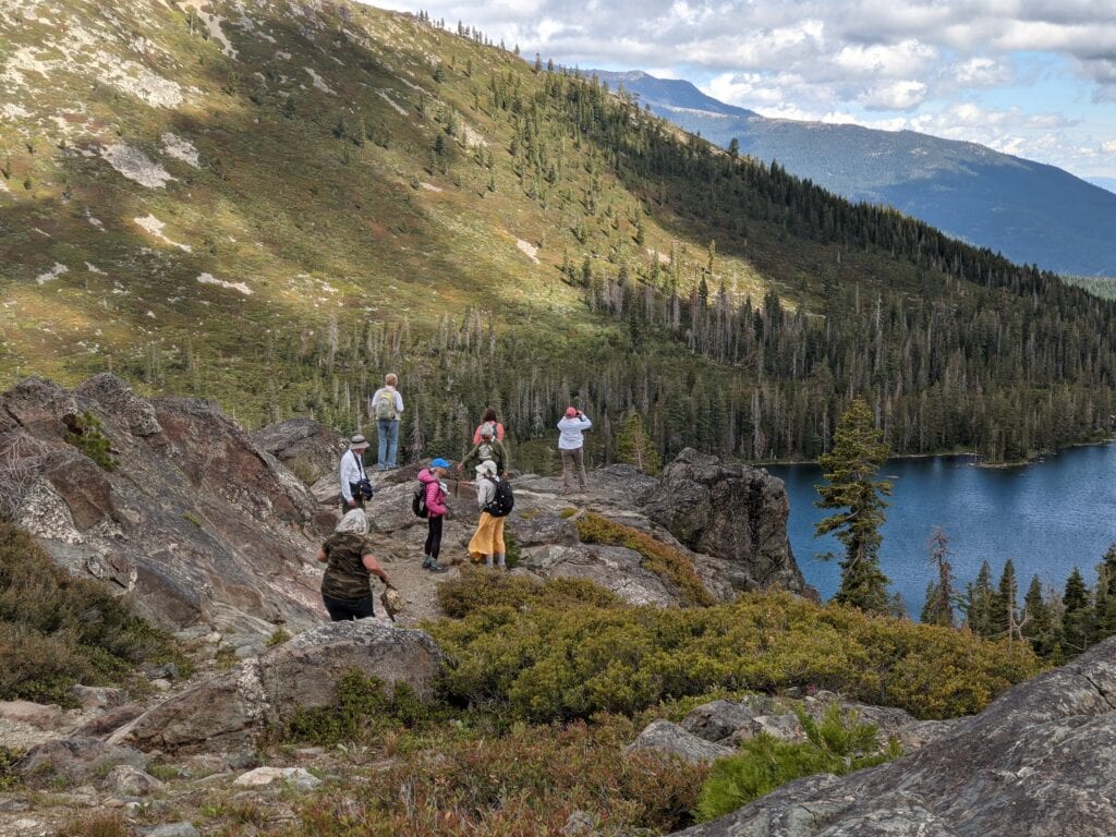
Pass through the saddle and drop down the short distance to Heart Lake.
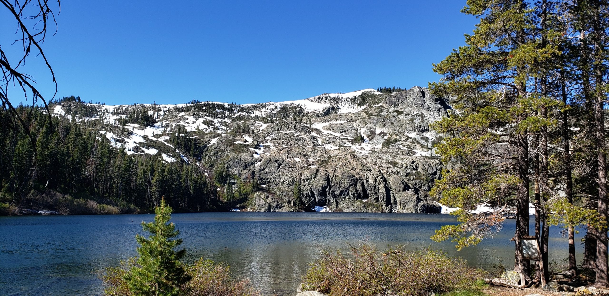
The view from this point is spectacular – Mount Shasta, Black Butte, the Eddys and Mt McLoughlin stand large, sentinels of the region. A short walk west of the lake reveals a couple tiny ponds and a campsite. Agile hikers in good shape can head southeasterly up to top of the ridge for world-class views of the surrounding topography.
Controlling Agencies:
Wilderness Land Trust
wildernesslandtrust.org
The Wilderness Trust currently holds the title to Section 19, which most of this trail passes over. It is under contract to be transferred to the Shasta-Trinity National Forest, with the expected change of title expected in June 2021.
Mount Shasta Ranger Station,
Shasta-Trinity National Forest,
204 West Alma, Mount Shasta, CA 96067
(530) 926-4511
Directions to Trailhead
Trailhead is accessed from Castle Lake parking lot. In winter the road does get snow, check the Mt Shasta Avalanche Center and USFS road conditions.
Support MSTA
MSTA develops and maintains trails in the Mount Shasta area, and advocates for hiking, biking and equestrian access. We are a volunteer-based 501(c)(3) non-profit organization and count on your support. Please consider giving back to your trails!