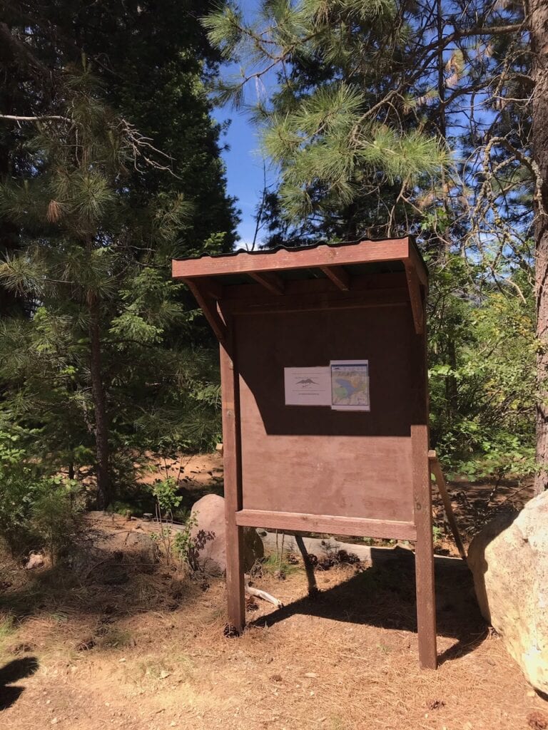
A big thank you to Mark Telegin and Paul Schwartz for installing yet another kiosk along the Lake Siskiyou Trail in the Spini Meadow area. The kiosk was fabricated by Mark in his garage, disassembled, then reassembled on site. The deep holes for the support posts and concrete were dug by a County work crew (thank you Jason Ledbetter and workers), which saved us the hardest part of the job. The new, three-foot lake maps are being manufactured and will be placed on the kiosks soon.
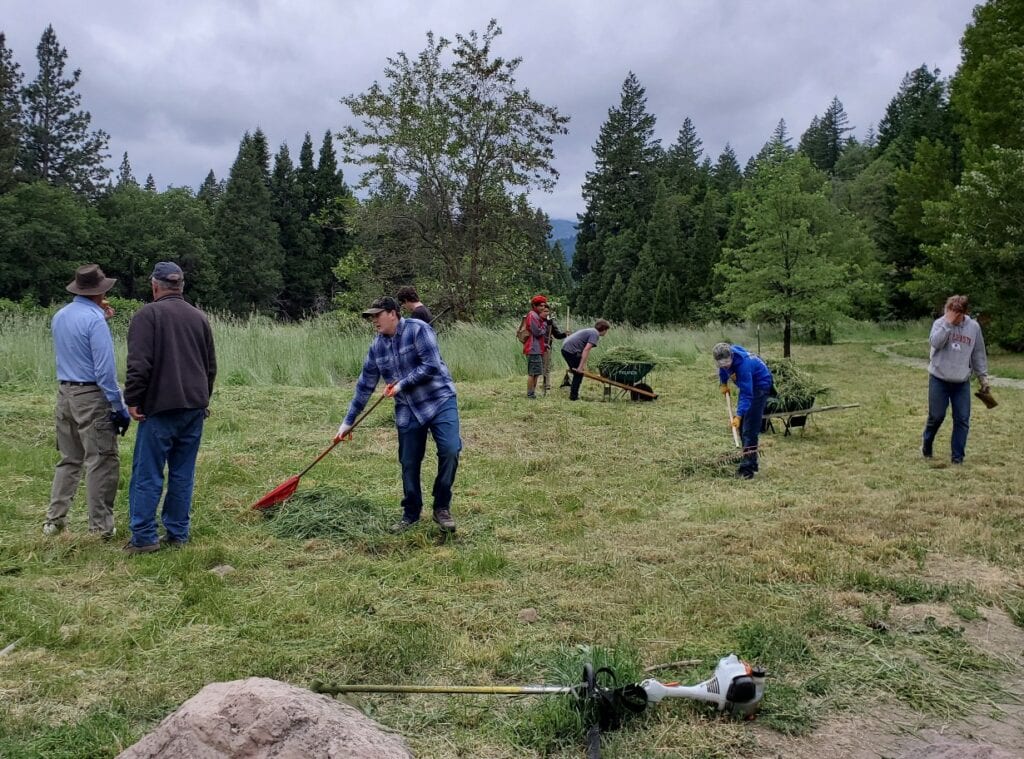
Last Wed., May 26, about 8 MSTA volunteers joined a dozen Boy Scouts and their scoutmasters to cut the weeds at an overgrown Spring Hill Trailhead. We had a bunch of weed whackers of various sizes and shapes, and the cut weeds were hauled by wheelbarrow to Bubba’s huge dump trailer and removed. We had some really young helpers alongside the scouts and MSTA regulars. Thanks to all!!
The Mount Shasta Trail Association is pleased to announce our second stewardship prize winner, Caryn Johansen. She is a volunteer for MSTA’s trail work days.
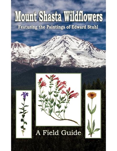
Our second steward award is sponsored by Jane Cohn, Michael Zanger, Linda Freeman and Ken Goehring. They donated a copy of their book, Mount Shasta Wild Flowers A Field Guide.
Congratulations and thank you Caryn!
All prizes can be picked up at the Mount Shasta Visitors center.
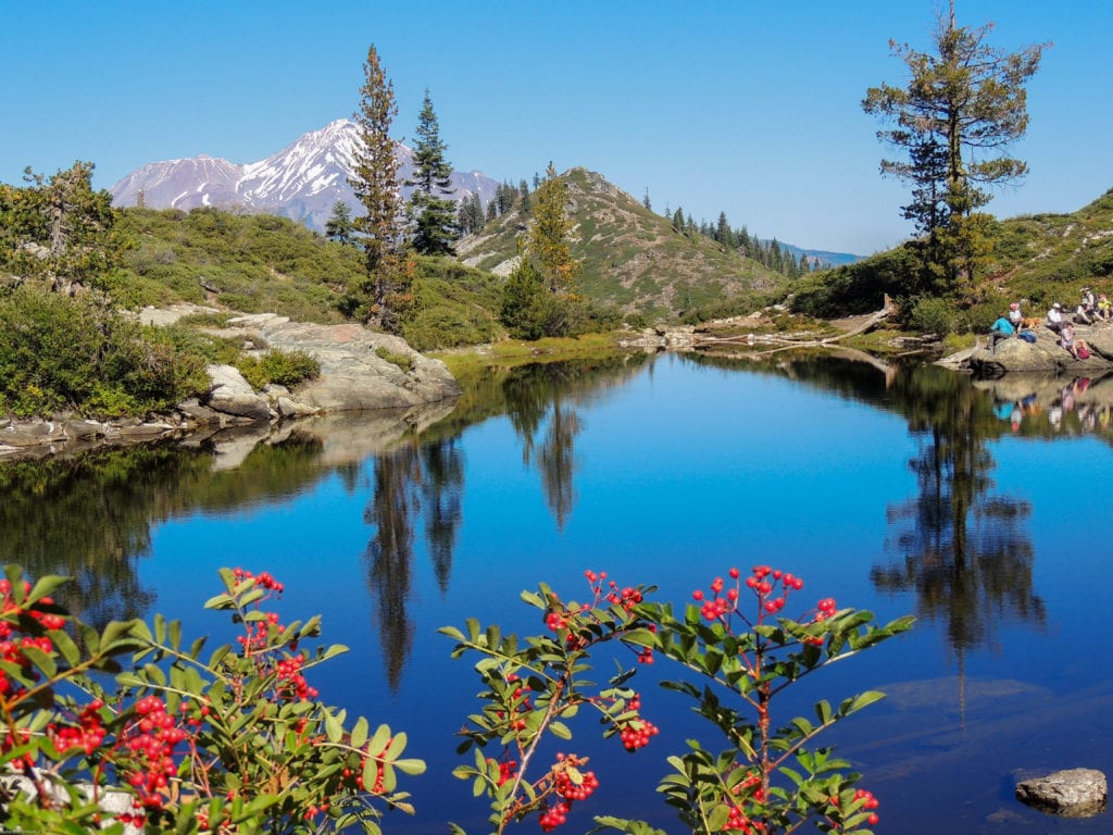
The Mount Shasta Trail Association invites the public to join us on one of the premier hikes of the region. We will walk 2.2 miles round trip above glacial sculpted Castle Lake to Heart Lake. This little alpine pond shaped like a heart has shallow waters warmed by the sun. The pond leads to a small ledge and beyond to a plummeting valley that rises up to 14,162 ft. Mt Shasta. The views are eye popping and jaw dropping. This moderate sometimes strenuous hike with a 600 ft. elevation gain is well worth the effort.
An interesting note: the saddle above Castle Lake just before we head up to Heart Lake is in an area of the Indian battle with the U.S. Cavalry where Joaquin Miller, poet of the Sierras, was wounded by an arrow that pierced his throat in June of 1855. Miller was a dubious historian as the facts are in issue.
We will meet in front of the Best Western Treehouse in Mt Shasta, 111 Morgan Way, at 9 am. Carpooling is an option. As we will be outside, we can be safely socially distant. Bring lunch, water and if interested, a bathing suit for a refreshing swim. Hiking poles are recommended. Expect to return by 3 pm. For further questions, call Joan Roemer 530 925 9644.
We’ll be doing another work day on the Gateway Reroute this Saturday at 9 am. Meet at the Gateway Trailhead for a short drive and then a 15 minute walk to the work site. Alyssa Winkleman will be directing the work.
The next opportunity will be a big effort up at Castle Lake on June 5 (National Trails Day) to make further progress on the new trail to Heart Lake.
We’ll be cutting weeds and cleaning up the Spring Hill Trailhead with the Boy Scouts on Wed., May 26 at 6 pm. This is an annual event that is a lot of fun. If you commit one hour, we’ll power through the job (the Boy Scouts and their dads did most of the work the last few years!). Bring weed whackers and rakes. See you there.
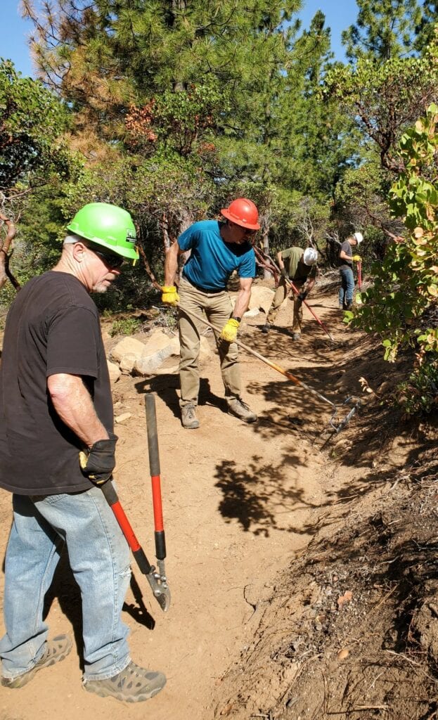
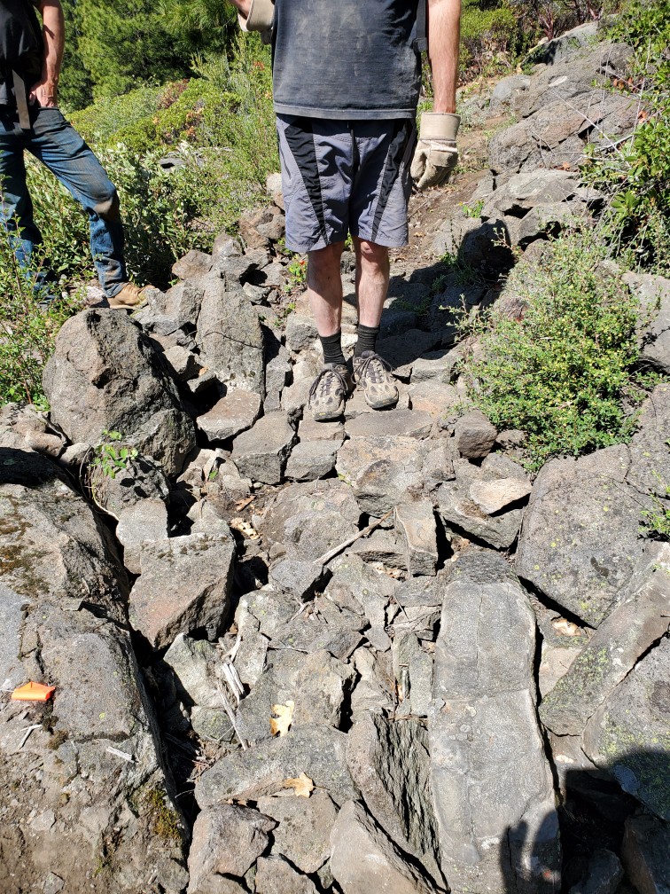
Yesterday, Sunday the 16th, we had 12 volunteers rake and remove roots from the Gateway Reroute Trail. The views were spectacular. We got nearly the whole thing done, but there remains a lower section of about 400 feet that will need to be brushed out and finished later. There are also three rocky sections that will require some careful jigsaw puzzling of rocks to create flat, solid trail. The rock work is fun and creative, so if you want to help with this, contact Alyssa Winkleman, who will be leading this effort in the next 2 weeks.
The Mount Shasta Trail Association is pleased to announce our first stewardship prize winner, Jessica Jorgensen. Jessica is an avid hiker and member of The Siskiyou Wanderers (link). She is also a volunteer for MSTA’s trail work days.
Jessica won a $25 Mount Shasta Chamber of Commerce gift certificate that can be used at local businesses. This prize is sponsored by the MSTA.
Our second steward award is sponsored by Jane Cohn, Michael Zanger, Linda Freeman and Ken Goehring. They are donating a copy of their book, Mount Shasta Wild Flowers A Field Guide pictured below. Stay tuned for our second award drawing! All prizes can be picked up at the Mount Shasta Visitors center.
Due to the overwhelming interest in the chainsaw training course and the fact that a chunk of our regular trail workers will be attending that class, we have to change the trail work day to Sunday. Please meet at the Gateway Trailhead on Everitt Memorial Hwy at 9 am on Sunday, May 16. We’ll probably drive a short distance up the gravel road, park, and walk about 10 minutes to the Gateway Reroute for finish work on the trail that’s being worked on this week by Trail Labs Co.
You will be amazed by the views on the new reroute. We’ll work from 9:30 to about noon or so, but you can leave anytime you wish. We just want to see your smiling face on the trail.
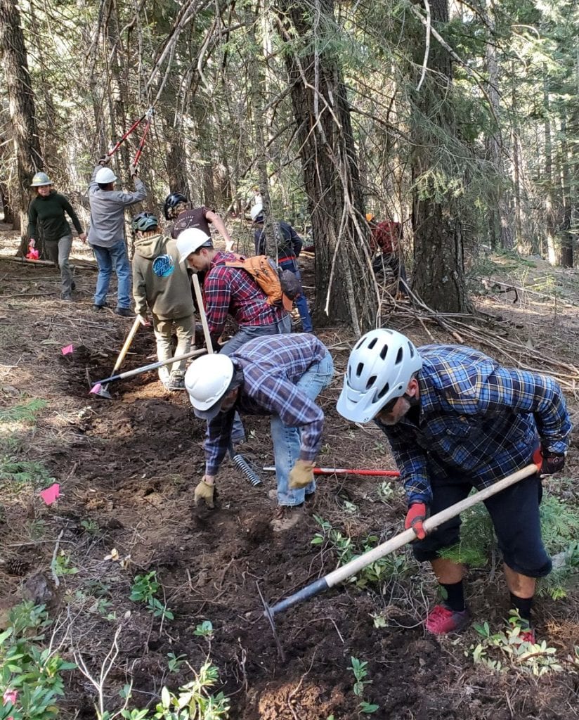
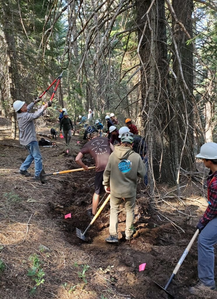
Twenty-eight volunteers showed up to cut new trail on Bear Springs on Saturday! There were regulars, new people, and very eager teenagers. We created a long segment of trail. One more work day like this and we’ll connect down to the top of MX. Just look at the incredible, long line of workers. Thanks to MSTA, Bike Shasta, and Shasta Gravity Adventures for this fun day in the forest.