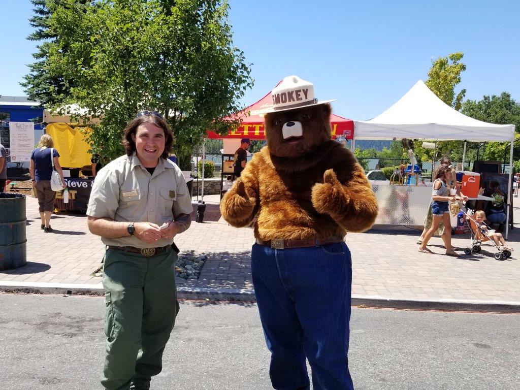
VOLUNTEERS NEEDED FOR PRUNING ON THE TRAIL TO BRADLEY RIDGE
The Siskiyou Wanderers hiking group has scheduled a trail maintenance day for Thursday, November 8 and need volunteers to help with the pruning. We will hike from Castle Lake to the work site at Bradley Ridge, above Dunsmuir. It is approximately 4 miles each way. Please meet at the M.S. Fish Hatchery at 8am with 1-2 of your favorite pruning tools (pruners, hand saw, lopers, rake …). Bring water and a lunch for a beautiful hike to a wonderful area to do some badly needed trail maintenance. For further information, contact John Thompson, scribe (530) 926-4430 or Steve Russell (916) 212-4478.
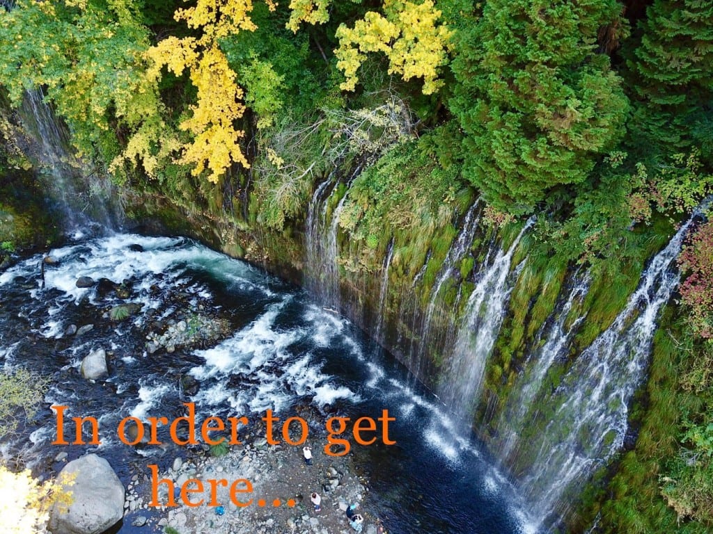
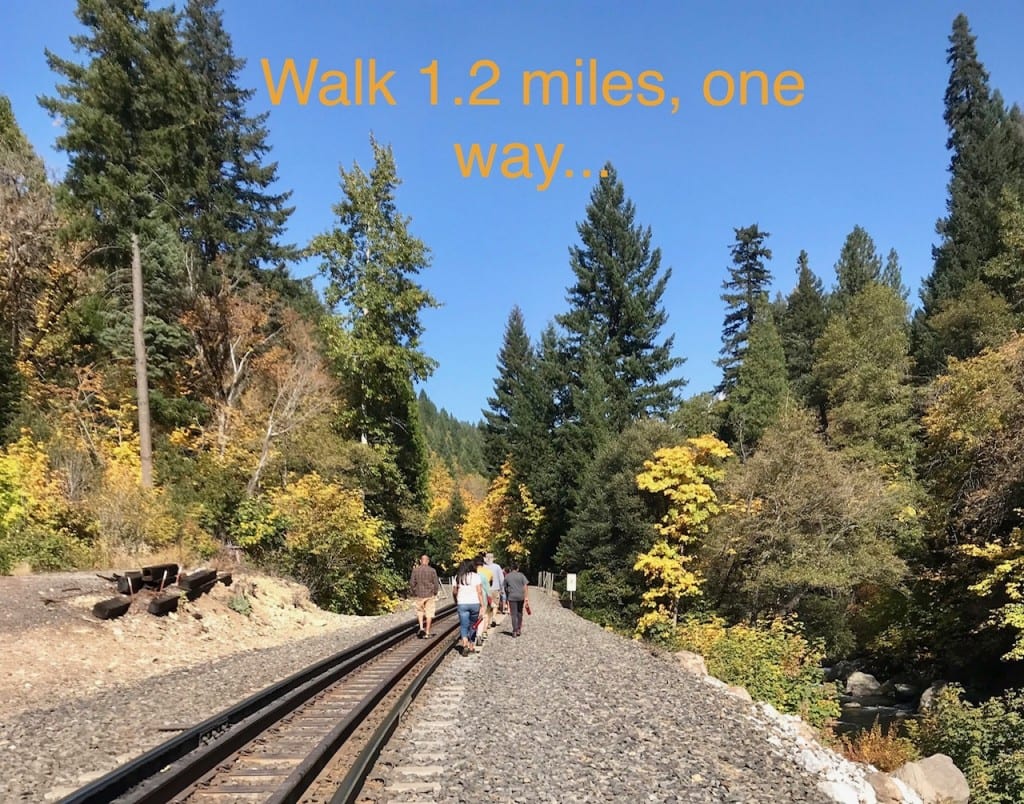
Mossbrae Falls is a stunning destination in Dunsmuir, CA, and it’s visited by thousands of people each year. Getting to the falls, however, is difficult.
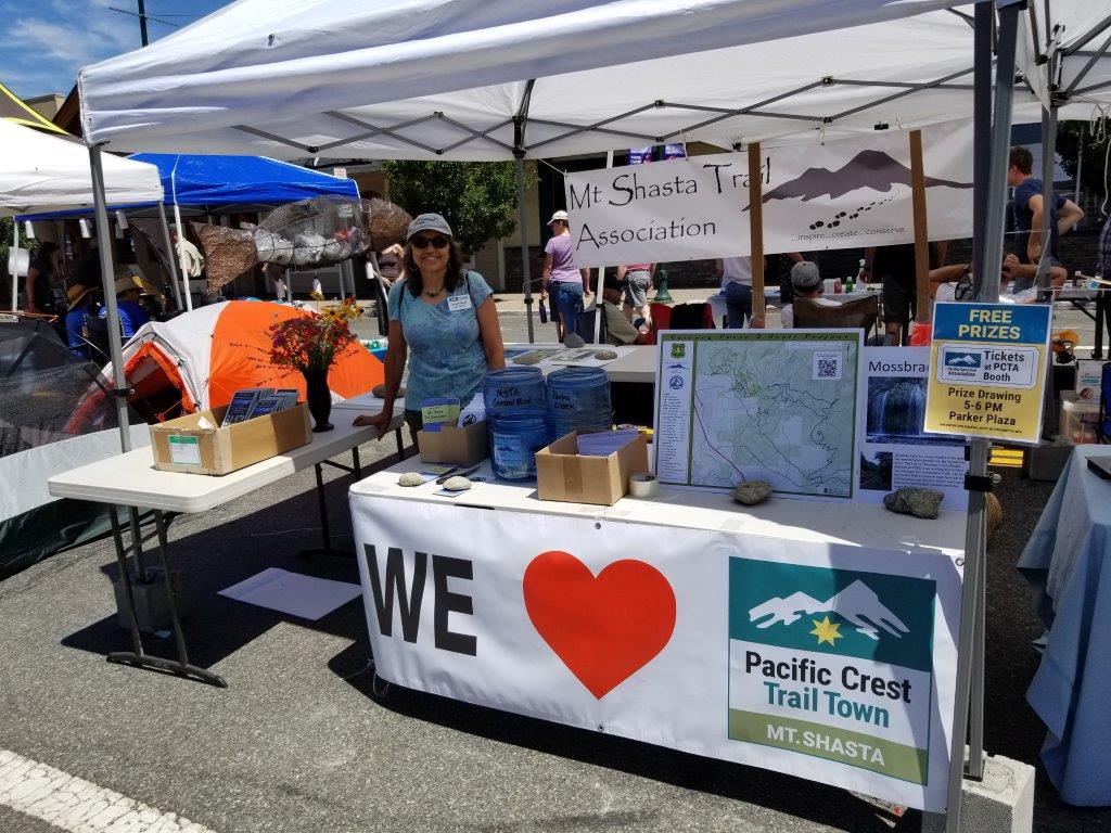
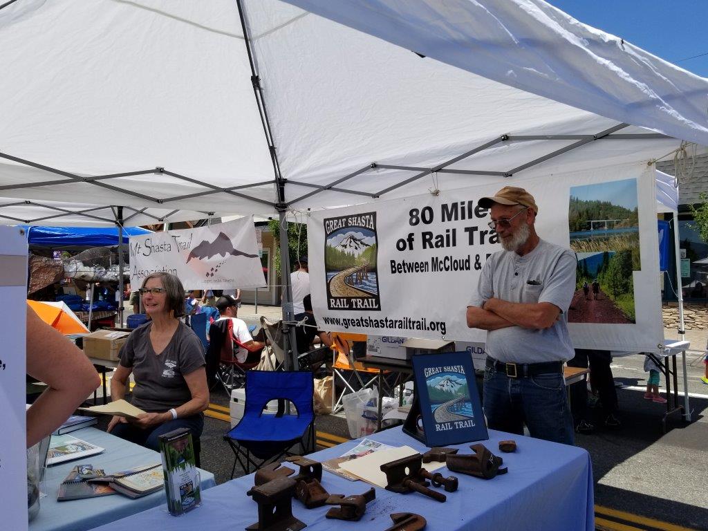
The Mount Shasta Trail Association is engaged in a plan to create a safer, easier path to the falls, but it will cost around $750,000, by conservative estimates. One donor has primed the pump with a $300,000 gift. We will rely on other large grants and donations, but we need your help to finish this project. Please join us in making this dream a reality by donating to the Mount Shasta Trail Association on Giving Tuesday, Nov. 27, 2018. www.northstategives.org/mountshastatrailassociation
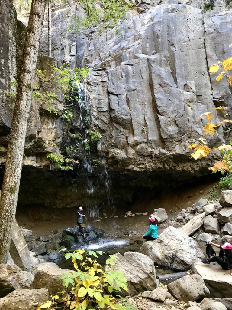
The attached photos give a visual representation of the falls, the current route, and the solution.
A small group (Mark Telegin, Neil Jacobs, David Tucker, and Steve Russell) have put in many hours to construct a new bridge to replace a crumbling one in Castle Crags State Park. The research and engineering were done by Mark. The bridge was totally constructed in Mark’s garage, then disassembled and hauled to CCSP. On Friday morning, we’ll begin the work of prepping the site, hauling the bridge to the site, and putting it together. We could use a few extra hands. See the instructions for where to meet from Mark, below.
“I have talked to most of you about working on Friday at Castle Crags. At 9 am we will be meeting at the Flume Camp ground, out by the pond, which is about a mile up the paved road from the main entrance to the park. Bring tools for ground work like shovels, picks, rakes, loppers and gloves. There are some logs in the creek along with rocks and debris to work on. We will also be tending to the old bridge. I’m not sure how long it will take to prep the site, but we will talk about installing the new bridge while we are working and figure out when we can start on the last part of the project.” Mark
Take a look at the bridge. Unbelievable job, I think. Guys, thanks for keeping our parks beautiful.
On Wednesday, Oct. 24, at 10:30 am, we’ll be tackling the cleanup of a large abandoned encampment near Ray’s Food Place. Let’s meet on the street in front of the Treehouse Motel, just west of the Ray’s parking lot. We’ll depend on Todd and Perry to guide us to the spot. I’ll have garbage bags, rakes, brooms, and shovels, along with a pickup truck. Bring gloves and a pickup truck if you have one.
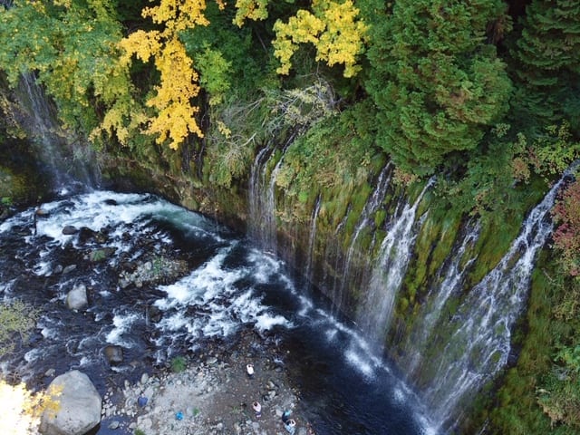
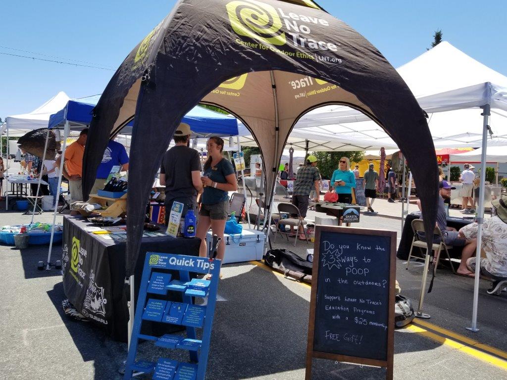
Mossbrae Falls, located in Dunsmuir, California, is one of the most beautiful natural features in the northern part of the state. Spanning about 300 feet, the falls seem to gush straight out of a lush, green hillside, providing a spectacular, cascading display for visitors. The sight is so special that people travel long distances to see it, coming from all over the world.
Unfortunately, the only way to access the falls is by trespassing along an active railway, and visitors must walk within a few feet of passing trains. Several years ago, a sightseer was struck by a train and severely injured.
The Mount Shasta Trail Association has been working for nearly 20 years to establish a safer path to Mossbrae Falls, without success. In the past 18 months, however, significant progress has been made. The current plan involves locating an official trailhead at Hedge Creek Falls, then constructing a pedestrian suspension bridge across the Sacramento River where the Hedge Creek Trail ends. The trail would continue north through a forested area below the train tracks and along the river, ending at Mossbrae Falls. The final trail would encompass both falls within about a half mile.
This is an exciting development, but it will be very expensive to complete the environmental reviews and actual construction.
The Trail Association has received a large gift to cover some of the costs, and is seeking grants to cover the remainder. In the meantime, we’re fundraising to show grassroots support for this wonderful project.
Please consider donating to the Mount Shasta Trail Association on Giving Tuesday, Nov. 27, 2018. The online event may be accessed using www.northstategives.org/nonprofits.
Stay tuned for more detailed information on this plan.
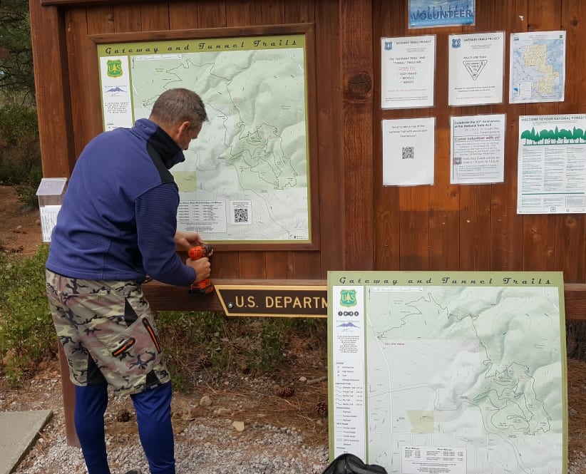
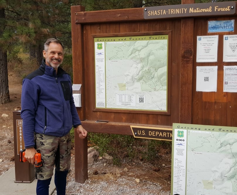
After considerable effort walking the entire Gateway Trail system to obtain accurate GPS data, a new map was created and placed on the trailhead kiosk on Sunday, Sept. 30, 2018. It includes the new Lollipop Trail, the correct alignment for Pig Farm, the Foundation Trail, removal of “Fern Loop,” naming of major intersections, and accurate mileage measurements between all these locations. Several “you are here” signs will soon be placed at strategic locations within the trail system. Pictured is Paul Schwartz, who has been instrumental in getting this project done properly.
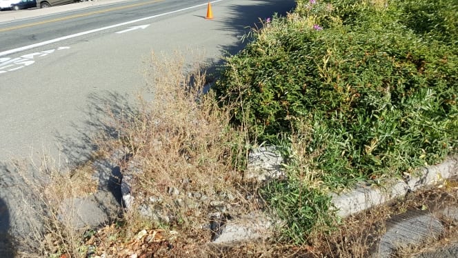
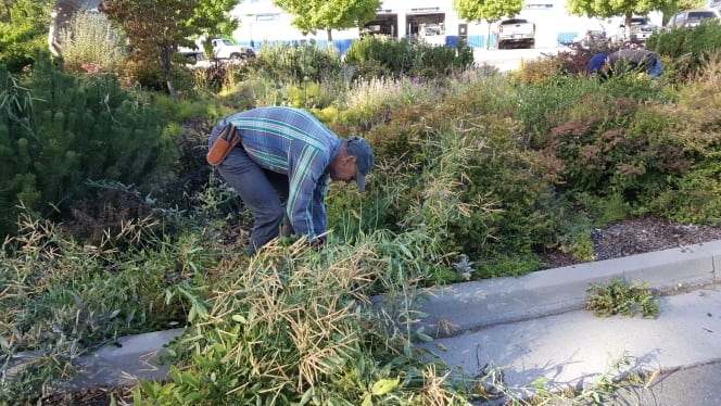
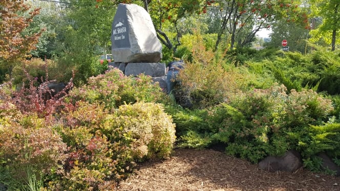
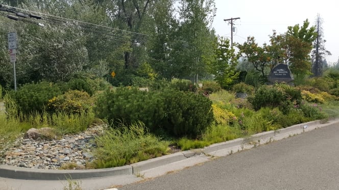
Yesterday morning a motivated group attacked the “Triangle” at the north end of town, weeding, raking, trimming, and spreading cedar bark. Thanks to Nancy and Peter Van Susteren, Neil Jacobs, Karen Aldous, Neal Posson, Lynn Linebarger, and Terez Maniatis of Native Grounds Nursery (who provided tools, cedar bark, and muscle, despite still being somewhat gimpy). This was a fun, combined effort by MSTA and the MS Beautification Committee. Attached photos are before, during, and after. By the way, in the “after” picture, you can barely see Peter removing the last two scotch broom plants.
We will be partnering with the MS Beautification Committee to trim, weed, and spruce up the median strip on Lake St. (Sat., Sept. 8 at 9 am) and the “Triangle” on N. MS Blvd., across from Point S Tire Co. (Sat., Sept. 22 at 9 am).
These are two highly visible areas that appear to most of our out-of-town visitors immediately on their arrival, so these efforts are important.
I will be out of town for Sept. 8, but there should be a good crew for that day. Hope some of you can show up for one or both mornings.
We expect that the work can be done in 1-2 hours if enough volunteers show.
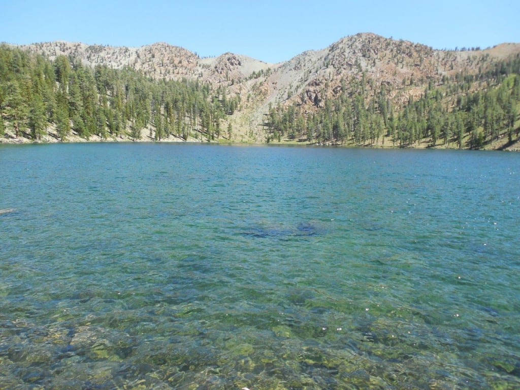
Once again, for the most amazing views, join the Mt. Shasta Trail Association on a day hike to pristine Deadfall Lakes and to the top of Mt. Eddy slated for Saturday, August 4th. This 10-mile round-trip hike starts out gently on the Pacific Crest Trail to the multiple lakes and then becomes challenging as we gain 2,250 feet to the summit at 9,025 feet.
Mt. Eddy was formed some 400 million years ago from peridotite, a volcanic form of serpentine. This type of rock, ultramafic, is high in magnesium and low in calcium, and as such the soils derived from this material constitute a harsh growing medium for most plants.
Like with other serpentine areas, the result is that some plants adapt to the harsh conditions, taking advantage of the relative lack of competition, and evolve to become endemic to the site. The iron contained in the rock rusts, giving it its reddish tint.
It is the highest mountain in the Eddys – a subrange of the Klamath Mountains – the highest point in Trinity County, and the highest mountain W of Interstate 5. The mountain was named after Olive Paddock Eddy, the first woman to climb Mt. Shasta.
From this majestic peak hikers will be able to see Lassen Peak, Mt. Mc Loughlin, the Scott Mountains, the Eddy Range, Black Butte, Castle Crags Spire and of course Mt. Shasta towering over everything in sight.
Participants will meet at 9 am at 111 Morgan Way, in front of the Best Western Tree House Motor Inn. Bring lunch plus snack and water and if interested, a bathing suit for a very refreshing swim. Hiking poles are recommended. Expect to return by 6 pm.